Friday, September 4, 2009

Quarry Rock, Deep Cove, North Vancouver


Things to Do: Walk, Hike

Dog Friendly: Yes

Distance from Vancouver: 21 KM; 30 Minutes

The trailhead begins along Panorama Drive past the park.


Driving Directions:


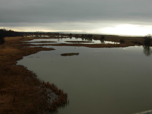
Just off the shores of scenic Deep Cove in North Vancouver sits a large rocky outcrop known as Quarry Rock (also known as Grey Rock in some hiking books). A hiking trail which is also part of the easternmost section of the Baden Powell Trail, leads to this point offering scenic views of Indian Arm and the mountains around Belcarra.

The start of the Baden Powell Trail begins along Panorama Drive just beyond the park area. Look for the sign on the left side of the street and walk up the edge of the driveway towards the wooden steps. The first section of the trail climbs quickly up the set of stairs and then up and over the maze of tree roots.

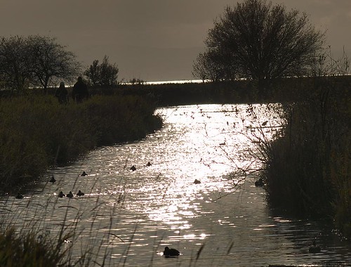
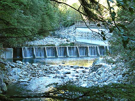
The terrain is typical of North Shore hikes; densely wooded areas of Douglas Fir and Hemlock trees, small creeks from mountain runoff, and the smell of fresh forest air. Continue over the small wooden bridge as the trail begins to level.

After 30 minutes, the trail heads down towards a large wooden bridge. Cross the bridge and ascend up a set of wooden stairs on the other side. Another 10 minutes and you reach a fork in the trail where the left side goes up a steep embankment. Go right towards the clearing in the trees as the trail climbs up onto the solid rock. You have arrived at the Quarry Rock. Climb up to the highest point to check out the view before staking out a spot to sit and relax.

On a warm, clear day, one could sit for hours enjoying the tiny boats below and scenic surroundings off in the distance. When it comes time to return, head back towards the clearing and back along the trail as it weaves through the forest and back towards Deep Cove.


How to get to Quarry Rock

Estimated Driving Time from Vancouver: 30 minutes

Head eastbound towards Highway #1 (Trans Canada Highway) and enter the highway heading northbound. Cross the Iron Workers Memorial Bridge, also known as the Second Narrows. Take the third exit (Exit #22) after the bridge towards Mount Seymour Parkway. After exiting the highway, stay in the right lane and immediately turn right at the lights onto Mount Seymour Parkway. Follow Mount Seymour Parkway for 5km until a traffic light at the bottom of a steep hill. Turn left onto Deep Cove Road and drive for a few minutes towards the community of Deep Cove. At the 4-way stop, turn left onto Panorama Drive and park in the parking lot or along the street. The trailhead begins along Panorama Drive past the park.

View a map of Driving directions to Quarry Rock.


Additional Information


dog icon Dogs at Quarry Rock

Dogs are allowed to be off-leash but under control at all times.

Sunday, July 26, 2009

GROUSE MOUNTAIN, NORTH VANCOUVER, BC

The Grouse Grind® Trail

The popular Grouse Grind® is a 2.9-kilometre trail up the face of Grouse Mountain, commonly referred to by Vancouverites as “Mother Nature’s Stairmaster.” Over 110-thousand hikers a year take on the challenge of the rugged terrain and steep climb, starting at the Valley Station and finishing at the Peak’s plateau, for a total elevation gain of 2,800-feet. The average climb takes just over an hour, with beginners requiring up to two hours to complete the trek.

Grouse Grind A Mystical Place by Arlene Gee.

grouse grind: grizzly bear by sheep sheep.


THE REFUGE FOR ENDANGERED WILDLIFE:

Grouse Mountain Bears by The Kids and Kahlie.


Imagine a wilderness sanctuary where endangered animals can play, protected and secure. You will find all this and more at The Refuge for Endangered Wildlife, a research, education, and conservation centre at the top of Grouse Mountain. Dedicated to becoming a world leader in preserving both flora and fauna at risk. The Refuge offers leading-edge interpretative programs that make learning about nature fun and fascinating.

The Refuge for Endangered Wildlife is principally comprised of a five-acre mountaintop habitat that is home to two orphaned Grizzly Bears, and a Grey Wolf habitat located at the base of the mountain. The Wildlife Refuge is included with your Grouse Mountain Admission. Be sure to come up early in the day so you can fit them all in.


ECO-WALKS

Map of the mountain by kimba.

Grouse Mountain Peak by lasalli.


REIFEL BIRD SANCTUARY, DELTA, BC

ADDRESS: 5191 ROBERTSON ROAD, DELTA, BC

DISTANCE FROM VANCOUVER: 35KM, 50 MINUTES

DRIVING DIRECTIONS:


HOURS: 9AM - 4PM DAILY

George C. Reifel Migratory Bird Sanctuary is a protected area in Delta, British Columbia, Canada and is part the the Fraser River estuary. The area includes managed wetlands, marshes and dikes. The 300-hectare (740-acre) area has numerous walking trails, bird blinds, lookouts and a gift shop. It has resident nesting sites for Sandhill Cranes, Bald Eagles, Mallards, Spotted Towhees and many others. Migrants include, Lesser Snow Geese, Greater and Lesser Yellowlegs, Long-billed Dowitchers, and Western Sandpipers. Over 268 species have so far been recorded in the Sanctuary. The sanctuary is open year round from 9 am to 4 pm local time.

Our Reifel Bird Sanctuary VII by iano50.

Weird Weather Day-Reifel by iano50.

Reifel Bird Sanctuary 1 by blue_topaz.

A Duckling Candid by J Bespoy.


RICHMOND NATURE PARK, RICHMOND, BC

ADDRESS: 11851 WESTMINSTER HWY, RICHMOND, BC

DISTANCE FROM VANCOUVER: 16km, 30 MINUTES

DRIVING DIRECTIONS:


Richmond Nature Park 5 by iano50.


Facility Hours

Nature Park: open daily from 7am until sunset. Admission is free.
Nature House: 9am - 5pm everyday, except December 25th & 26th, January 1 and November 11. Admission is by donation.

The Richmond Nature Park consists of 200 acres of the raised peat bog habitat that once covered large portions of Lulu Island. Four walking trails totalling 7 km in length provide visitors the opportunity to encounter plants and animals in bog, forest and pond habitats. The shortest trail, an elevated boardwalk around the Park pond, is wheelchair accessible. Other trails are soft-surfaced with wood chips. All trails are well marked, and a free trail guide is available in the Nature House.

The park is always changing. In spring, visitors can see and hear the territorial fights of the hummingbirds as bog flowers bloom below. Summer days are long, and the trails ideal for cool evening walks. Autumn brings owls, northern migratory birds, and spectacularly coloured foliage. In winter, visitors can hear varied thrushed and see winter birds at the feeders, or follow animal tracks in the snow.

The park is very fragile environment, so dogs and other pets are not permitted, and visitors are requested to remain on the marked trails. No plants, plant parts, or animals may be removed from the park. Please do not attempt to feed the animals, for your own safety and the health and safety of the animals.

Nature House
An interpretive centre located at the entrance of the Nature Park. It features interactive displays and games about the park, the bog, and other aspects of nature. There are activity kits, and active beehive, a small collection of live animals, and a gift shop.

Picnic Area
A covered shelter containing 6 tables is adjacent to the Nature House. There is a children's play area and wheelchair-accessible washroom near the Nature House. There are no food services in the park

CHINATOWN, VANCOUVER, BC

Vancouver's Chinatown by tiny bites.


Chinatown in Vancouver, British Columbia, Canada, is the Western Hemisphere's second largest Chinatown in area (after San Francisco), and third largest in population (after San Francisco and New York City). Centred on Pender Street, it is surrounded by Gastown and the Downtown Financial and Central Business Districts to the west, remnants of old Japantown and the Downtown Eastside to the north, and the residential neighbourhood of Strathcona to the east. The approximate street borders of Chinatown's commercial area are the alley between Pender Street and Hastings, Georgia, Gore, and Taylor Streets, although its unofficial boundaries extend well into the residential area east of the Downtown Eastside. Main, Pender, and Keefer Streets are the principal areas of commercial activity.

Due to the large ethnic Chinese presence in Vancouver—especially represented by multi-generation Chinese Canadians and first-generation immigrants from Hong Kong, the city has been referred to as "Hongcouver" (a term considered derogatory by some)[2]. Chinatown remains a popular tourist attraction, and is one of the largest historic Chinatowns in North America. However, it went into decline as newer members of Vancouver's Cantonese Chinese community dispersed to other areas of the metropolis. It has been more recently overshadowed by the newer Chinese immigrant business district along No. 3 Road in the Vancouver suburb of Richmond, which had been an Anglo-Saxon bastion until the 1980s. Many affluent Hong Kong and Taiwanese immigrants have moved there since the late 1980s, coinciding with the increase of Chinese-ethnic retail and restaurants in that area. This new area is designated the "Golden Village" by the City of Richmond, which met resistance to the proposed renaming of the area to "Chinatown" both from merchants in Vancouver's Chinatown and also from non-Chinese residents and merchants in Richmond itself.

Chinatown was once known for its neon signs but like the rest of the city lost many of the spectacular signs to changing times and a new sign bylaw passed in 1974. The last of these was the Ho Ho sign (which showed a rice bowl and chop sticks) which was removed in 1997. Ongoing efforts at revitalization include efforts by the business community to improve safety by hiring private security; looking at new marketing promotions and introducing residential units into the neighbourhood by restoring and renovating some of the heritage buildings. Current focus is on the restoration and adaptive reuse of the distinctive Association buildings.

Vancouver's Chinatown by Librarian In Black.

Capilano River Regional Park, North Vancouver, BC

ADDRESS: 4500 CAPILANO PARK ROAD, NORTH VANCOUVER

DISTANCE FROM VANCOUVER: 10KM, 15 MINUTES

DRIVING DIRECTIONS:


BICYCLES: YES

DOGS: ON LEASH

Capilano River Regional Park, North Vancouver - just minutes from downtown Vancouver

Hatchery MapDirections:
Capilano Road north (Capilano Road exit from Hwy #1 or North Vancouver exit off Lions Gate Bridge, then left up Capilano Road) .5 km past the Suspension Bridge. Turn left on to Capilano Park Road (look for sign “Capilano River Regional Park“) and proceed down 1 km to end of the road.

Hours of Operation:

  • Nov - Mar 8am - 4pm
  • Apr 8am - 4:45pm
  • May 8am - 7pm
  • Jun - Aug 8am - 8pm
  • Sept 8am - 7pm
  • Oct 8am - 4:45pm
The hatchery office hours are from 8am - 4pm, Monday to Friday. For more


LINKS: http://www.greatervancouverparks.com/ClevelandDam01.html

Saturday, July 25, 2009

LYNN CANYON PARK, NORTH VANCOUVER, BC

DISTANCE FROM VANCOUVER:


http://www.seethenorthshore.com/lynn/3576-21a.JPG

Lynn Canyon Park
is a municipal park in the District of North Vancouver, British Columbia. When the park officially opened in 1912 it was only 12 acres (49,000 m2) in size, but it now encompasses 617 acres (2.50 km2). The park has many hiking trails of varying length and difficulty. The Baden-Powell Trail passes through the park crossing over the Lynn Canyon Suspension Bridge.
The park is a second growth forest, with the most of the oldest trees being 80-100 years old. Evidence of logging in the area can be found in the many large stumps, complete with springboard notches. Cliff jumping is popular with Lynn Valley youth in the summer. The series of Stargate SG-1 and Atlantis both use the area for filming.

http://www.seethenorthshore.com/lynn/0154-28.JPG

Followers