Friday, June 26, 2009

GALIANO ISLAND, BRITISH COLUMBIA

FERRY ACCESS: TSAWWASSEN FERRY TERMINAL


Galiano Island by Fearon-Wood Photography.


A long, narrow island, and the driest in the Gulf Island chain, Galiano Island was named after the Spanish explorer Dionisio Galiano who sailed these waters in 1792. Galiano Island is the second largest of the Gulf Islands, after Saltspring Island.

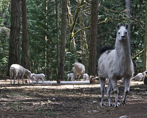
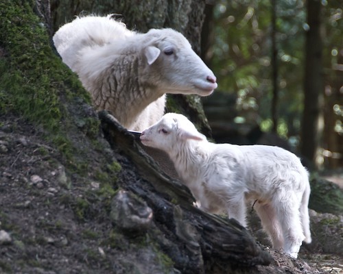
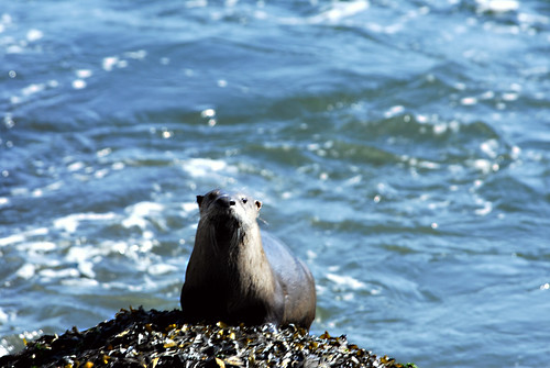
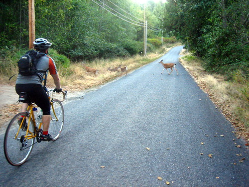
Galiano Islanders move at their own easy pace, respecting and protecting a fragile environment which is home to over 130 species of birds and many rare and protected plants.

Turkey Vulture at Galiano by dwboyd.

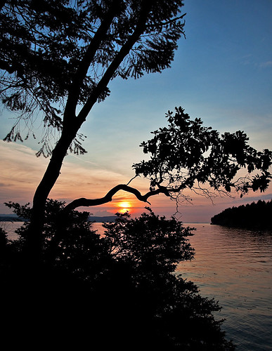
Rich in history and beauty, Galiano has been called The Jewel of the Strait of Georgia. For thousands of years before Europeans arrived, the Coast Salish aboriginal people had lived here, gathering a rich variety of foods from its forests and shores.


Stone creatures of Galiano Island, BC by kmax.


There are seven major islands in the southern half of the Strait of Georgia. Among them, Galiano Island has always enjoyed the reputation as being the most welcoming to visitors. This is due in large part to the limited amount of farmland on Galiano in comparison to other islands. Of necessity, early settlers here opened their homes to tourists as a way of earning a living.

Galiano Island by flyer_e901.

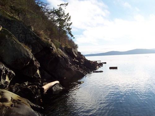
Despite being the first stop off the Tsawwassen ferry, Galiano Island retains an undeveloped, secluded character. Dedicated residents have worked hard to protect the natural features that extend along the island's narrow, 19-mile (30-km) length. The community and its supporters have purchased several areas as ecological reserves, including Mt. Galiano, Mt. Sutil and more recently, Bodega Ridge, whose rocky Bluff is unique in Western Canada. These eco-sensitive areas will be kept as forests in perpetuity by the Galiano community for the enjoyment of all.

Galiano Island by jeanniepaul.

Galiano Island has one gas station, grocery stores, a pub, no bank, and a few stores, including some interesting craft galleries and craft shops, all clustered at the southern end of the island. Many of the island's amenities are found near the ferry terminal at Sturdies Bay, but little treasure spots oare dotted throughour the island.

Galiano Island by jeanniepaul.

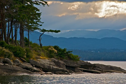
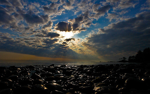
Today, Galiano is the hub for sea-kayak trips and the site of Montague Harbour Provincial Marine Park, one of the largest provincial parks on any of the islands. Galiano Island has the most dedicated park land of all the Southern Gulf Islands. There are seven beautiful parks, and miles of old logging trails and country lanes. There's literally something here for everyone, whether you're beachcombing or birdwatching, walking or hiking, mountain biking or horseback riding - it's the perfect setting for your adventure vacation.

Galiano Island by ireena 1.


Population: 1,035

Location: Galiano Island is located midway between Victoria and Vancouver, accessible by ferry from either the Tsawwassen ferry terminal on the BC mainland or the Swartz Bay terminal, north of Victoria on Vancouver Island.

Galiano Island by Nick Sherman.

  • To get a real feeling for island life, check for upcoming events, attend a concert, craft fair, studio tour, art exhibit, festival or a local dance.
  • The Galiano Museum has excellent exhibits, including an extensive photo gallery, on the area’s Aboriginal people and early European settlers. To see the final resting place of early pioneers, visit Galiano Cemetery.
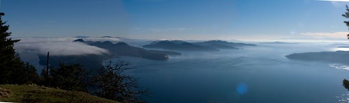
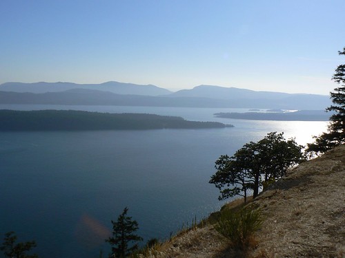
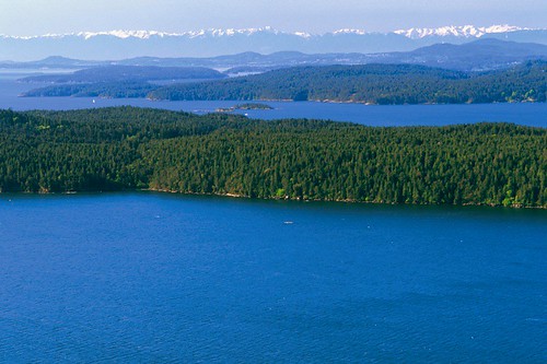
  • Climb Mount Galiano and see for miles and miles - enjoy awe-inspiring views of the Coast Mountain Range, Vancouver Island, the Gulf and San Juan Islands, and Mount Baker and the Olympic Peninsula in Washington State.

Panoroma Mount Galiano by gmoore230.
View from Mount Galiano by stephengg.


  • Gulf Island Arbutus trees
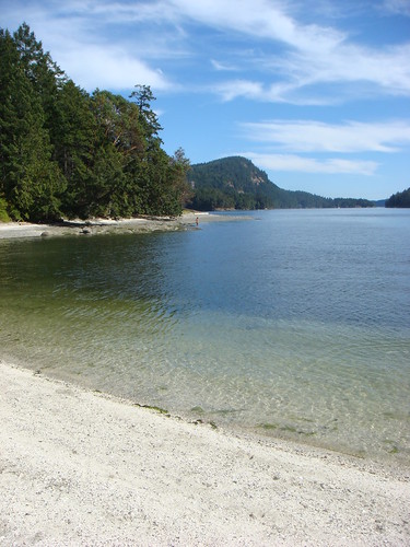
    The day-use area of Montague Harbour Marine Park offers a wonderful sandy beach. Although not exactly warm, the shallow waters here are bearable for swimming. You can walk along the peninsula until you find another white shell beach of your own. Other swimming areas with beach access can be found at Georgeson Bay, Cain Bay and Retreat Cove.
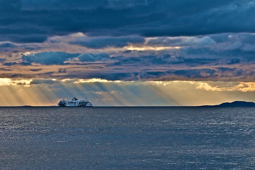
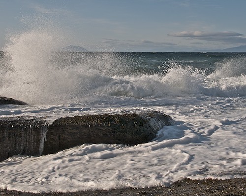
  • Active Pass and Porlier Pass offer excellent scuba diving, sports fishing and kayaking. Consult tide tables to determine the most favourable times to negotiate Active and Porlier Passes, at the south and north end of Galiano Island, respectively. As Active Pass is used by BC Ferries, use extreme caution when navigating here.

fishing with john... by iwanna.
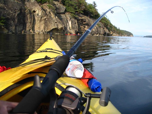
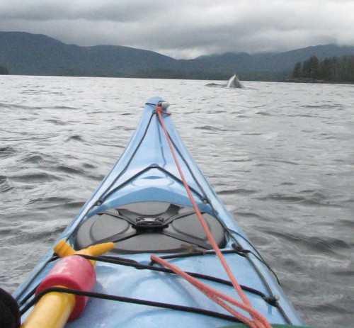
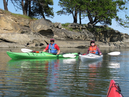
  • Exploring offshore waters in a sea kayak is the best and most soulful way to discover the Islands, and Galiano Island is the centre for sea kayaking in the southern islands. If you bring your own kayak or canoe with you, BC Ferries treats them as hand baggage and there is no charge. If you wish to rent, you won't have to walk farther than the first intersection north of the ferry dock at Sturdies Bay to rent kayaks and canoes. Kayaks, boats and moped are also rented out of Montague Harbour Marina.

2009_May_Mayne Island 054 by Toddish McWong.
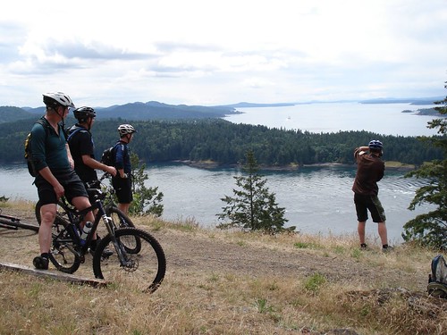
  • Of all the southern islands, the rugged and spiny Galiano Island has the most well-organized mountain biking trail system. Bluffs Park is the site of some spectacular views and the beginning of a network of trails and roads around Mount Galiano. From Sturdies Bay Road, go south on Burrill to Bluff Road, then west from here to the park and beyond.

Prevost Island from Mount Sutil, Olympic Range Mountains by Lony Rockafella | Photography.
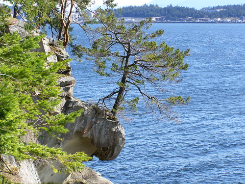
  • Along the crest of Galiano Island's long sandstone spine, the Bodega Ridge Trail loops through a rare coastal habitat of Douglas fir, hairy manzanita, and Garry oak. Following the 328-m ridge, the first half of the trail encompasses a panorama that includes the Trincomali Channel, the hilly profile of Saltspring Island, and the shadowy outline of the mountains on Vancouver Island. In contrast, the second half of the trail loops beneath the shade of tall Douglas firs, along paths and old logging roads heavily overgrown with hip-high salal, nettles, and brambles.

    The well-used trail starts at the faded Bodega Ridge Nature Trail sign at the end of Cottage Way. Cottage Way is off Porlier Pass Road, about 12 miles (19 km) north of the Sturdies Bay ferry terminal. Five minutes of gentle, uphill walking through salal growing under a canopy of Douglas firs brings you to a clearing of Scotch broom. At the far end of the clearing, a sign cautions, 'Proceed at your own risk. Steep rugged terrain.' Just past the sign, the trail divides. Bear left here. Farther along the trail, past another sign warning of the impending dangerous terrain, the ridge drops away dramatically, revealing a magnificent view across the islands, mountains, and water.


Galiano High Point by kendyck1.
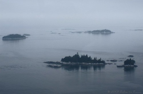
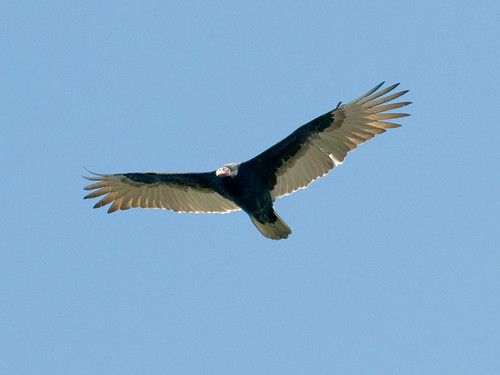
  • Far below, Wallace Island sits squat in the middle of Trincomali Channel. The Secretaries, Mogli, Norway, Hall, and Reid Islands lie like stepping stones in the narrow strait between Galiano and Salt Spring Islands. Farther northwest, beyond Kuper and Thetis Islands, lurk the shadowy outlines of the mountains of Vancouver Island. Spreading in a soothing collage of blues, greys, and greens, the unfolding scenery is balm to citified eyes. Heading north along the edge of the ridge between the arbutus trees and clumps of hairy manzanita - this shrub grows more profusely on Bodega Ridge than anywhere else in the Gulf Islands - you'll reach a large slab of sand right on the ridge edge. Less than 2 miles (3.22 km) from the trailhead, you may well have spotted a turkey vulture or two by now. At a distance it's easy to confuse immature bald eagles with turkey vultures. Both birds soar in a similar way, and even with binoculars it is difficult to make out the red heads of the vultures.

  • Visitors are welcome at the well-maintained golf course at the Galiano Golf & Country Club, and the clubhouse features a licensed restaurant.
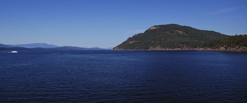
  • Although Montague Harbour Provincial Marine Park on the west side of Galiano Island was BC's first marine park, it has become just as popular with drive-in and cycle-in visitors as with boaters (boats may be launched at the ramp in Montague Harbour Marine Park). The 89-hectare park is one of the Gulf Islands' most popular parks, lying 5 miles (8 km) north of the BC Ferries dock at Sturdies Bay. Some of the walk-in sites are located in an ultra picturesque wooded setting on a small ridge above the harbour. Shell beaches and warm summer swimming are particularly attractive to families, and hikers can hike the trails at Gray Peninsula.
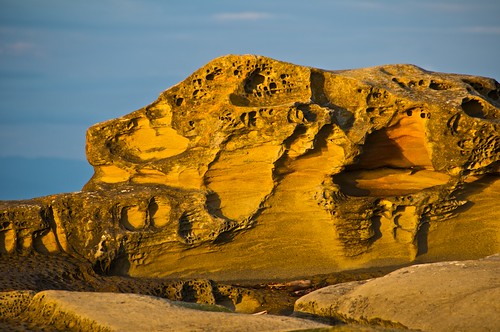
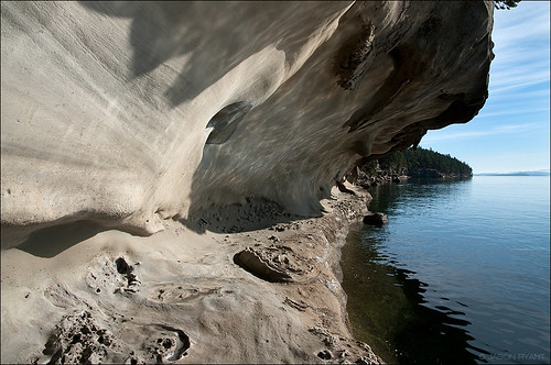
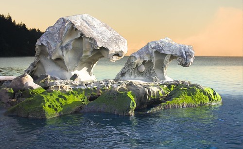
  • Take in the spectacular views from the 141-acre park Dionisio Point Provincial Park at the northeastern tip of Galiano Island. Much of this park has a weathered-limestone shoreline, characteristic of both Galiano and Gabriola Islands. Boaters can choose to land at pebble beaches on either side of Dionisio Point and thus avoid the tidal currents in Porlier Pass. Dionisio offers spectacular mature forests, rocky points, sandy beaches and a tidal lagoon.

don't hit the deer! by kathrynaaker.
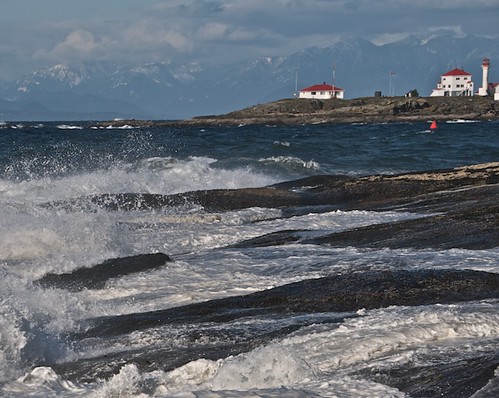
  • Galiano's Bellhouse Provincial Park is named in honour of the first innkeepers on the island. Besides the small beach here, the park's main attractions are the wildly shaped limestone formations on the shoreline of Active Pass and the parade of large ferry boats that squeeze through the waterway that separates Galiano and Mayne Islands. This is a dream location for photographers. Bellhouse is only a short walk north from the ferry dock at Sturdies Bay and is well marked. Pause here to rest and picnic before heading uphill to Bluffs Park, another good picnic location at the south end of Galiano.
  • Upswelling currents bring cold, nutrient-rich water to the surface around narrow passages between islands, such as in Active Pass, which divides Galiano and Mayne, and Porlier Pass, between Galiano and Valdes. In April and early May, thousands of Bonaparte's gulls, decked out in their black-headed breeding plumage, gather to feed on tiny shrimp or krill that float on the surface of Active Pass. Herring runs at this time of year attract California sea lions and bald eagles as well as hundreds of jet-black Pacific loons and Brandt's cormorants.

Bald Eagle, Mount Sutil by Lony Rockafella | Photography.
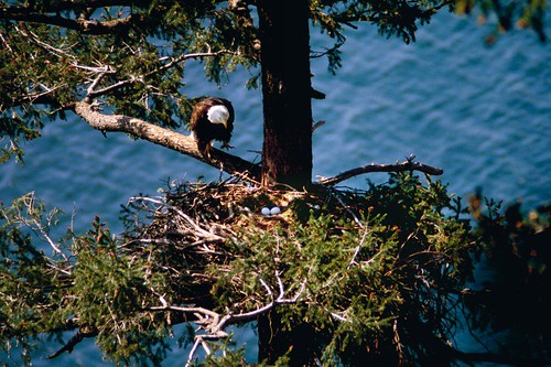
  • Saved by the determination of the island's 950 permanent residents, the trail and the 368-acre (150-ha) Bodega Ridge Nature Preserve - with its nesting bald eagles and peregrine falcons, and a separate 5-mile (8-km) section along the shore - could have been lost in perpetuity. However, in July 1995 the federal and provincial governments, together with The Nature Conservancy of Canada, purchased the land, and with the help of the newly established Pacific Marine Heritage Legacy agreement, the preserve has been saved. Turkey vultures call Bodega Ridge home, and there's a good chance that if you walk up on the ridge you'll see them circling on the updrafts. Others sit hunched at the top of skeletal Douglas fir trees and look down with beady eyes. Even if you've never seen a turkey vulture at close quarters, you'll instantly recognize its bald, red head, which definitely does look like a turkey.
  • Island Hopping
    Travelling between the Southern Gulf Islands and Northern Gulf Islands can be accomplished in small hops. Each of these islands is a world unto itself, each with its own history, culture and colourful characters - each island deserves at least a day or two for exploring.

Sandstone Cliffs @ Retreat Cove - Galiano Island, BC by Amy Honey.


GABRIOLA ISLAND, BRITISH COLUMBIA

DISTANCE FROM VANCOUVER: 25 KM

LOCATION: 5 KM EAST OF NANAIMO, VANCOUVER ISLAND

FERRY ACCESS: LINKED TO NANAIMO BY FERRY


http://www.purewest.com/accommodations/salt_spring/gulf%20islands.gif


View of the southern gulf islands the morning I left by Johnz.


Known as Petroglyph Island, a nickname acquired because of its wealth of ancient native stone carvings, Gabriola Island is one of the enchanting Gulf Islands of British Columbia.

The island's name is derived from Punta de Gaviota (Cape Seagull), the name given by the Spanish to the southeastern part of the island in 1791. This name was later corrupted to Gaviola and later to Gabriola. Other island names dating back to Spanish exploration of the Strait of Georgia include Descanso Bay and Malaspina Galleries.

In a pleasant rural setting of forested parks and quiet beaches, Gabriola's residents enjoy a mild temperate climate, a relaxed lifestyle and a strong sense of community. Picturesque roads lead to sensational ocean views, and the sandstone shoreline can be walked almost indefinitely. The population is concentrated on the north and south ends of the island, with a friendly rivalry enjoyed between north and south islanders.

Many of Gabriola's residents are retired, but just as many commute daily to Nanaimo to work. The island is known for its many artisans, with a thriving cottage industry in pottery and other arts and crafts. Watch for signs around the island and at local craft shops.

The kidney-shaped Gabriola is third in population size, after Saltspring Island and Quadra Island, and is one of the more accessible islands in the Gulf Islands chain, reached by a 20-minute ferry ride from downtown Nanaimo to the BC Ferries terminal at Descanso Bay.

Population: 4,000

Location: Gabriola Island is located in the Strait of Georgia, between Vancouver Island and the mainland of BC, approximately 3 miles (5 km) east of Nanaimo on Vancouver Island. Gabriola is easily reached by a 20-minute ferry ride from downtown Nanaimo, or by floatplane from Vancouver (15 miles/24 km).

  • The Gabriola Museum tells the story of this small island in the Strait of Georgia; the petroglyphs carved by its aboriginal inhabitants; its discovery by Spanish explorers; later settlement by European immigrants; its climate, plants and animals.
  • More than 50 petroglyphs have been discovered under thick moss at Jack Point, Lock Bay and Weldwood - best known is a carving of a killer whale found near Degnen Bay

  • A bird's-eye view of Gabriola Island
    For a special insight into the aboriginal mythology of the Cowichan Nation, take time to view the petroglyphs carved in the rock face of a field behind Gabriola United Church on South Road. Follow a trail behind the church through the forest to an open field and begin exploring the rock face for ancient images.
  • Discover the Isle Of The Arts - visit the many artist's studios, galleries and delightful shops.
  • Be sure to visit the busy Farmers Market on Saturdays from the May long Weekend until Thanksgiving. Enjoy island fresh produce, baked goods and crafts.
  • Gabriola Island is one of the best places in the Gulf Islands where you can still pick and eat fresh oysters, mussels and clams.
  • Gabriola Island offers an abundance of wildlife, including resident and transient killer whales, sea lions, seals, otters and bald eagles.
  • The island is served by a challenging nine-hole golf course overlooking Hoggan Lake. Gabriola Island Golf & Country Club offers a full service clubhouse that always welcomes non-members.
  • Surrounded by some of the best cruising grounds on the BC coast, Gabriola is ideal for sailing, luring mariners and outdoor adventurers from around the world to the Gulf Islands.
  • The sheltered havens of Silva Bay and Degnen Bay provide anchorage and mooring facilities for local and visiting boaters. The waters of Georgia Strait to the east can provide exhilarating sailing, while more protected waters lie to the south of the Island. The Silva Bay Yacht Club provides a venue for those persons interested in participating in boating related events.
  • One of the most soulful ways to explore the Gulf Islands is in a sea kayak. Safer and more stable than a canoe, sea kayaks allow you to travel in comfort, with as much gear and goodies as you can manage to stow into the ample storage compartments fore and aft. If you bring your own kayak or canoe with you, BC Ferries treats them as hand baggage and there is no charge. The calm waters to the southwest of the Gabriola provide an excellent area for kayaking. Paddlers can launch at Silva Bay.
  • Divers come to Gabriola Island for the spectacular passes, rocky pinnacles and colourful marine life, including wolf eels and the giant Pacific octopus. You can dive from shore at the 20-hectare Drumbeg Park, or do a boat dive on Rogers Reef whilst remaining out of the treacherous current that can run at 8 knots through Gabriola Passage. Diving in the passage is for experienced divers only - near slack tide, on the ebb.
  • One of the best places to begin a boating fishing trip in the Gulf Islands is from Silva Bay at the south end of Gabriola Island. The nearby Flat Top Islands are a guaranteed hotspot to mooch for salmon. It's hard to keep a secret. You can tell where the fish are biting by looking to see where boats are congregating.
  • Although there are no long or recognized hikes on public lands, it is possible to hike from one end of Gabriola to the other along the central spine of high ground and enjoy panoramic views and tranquil woodlands. The beautiful sandy bays and long exposed shores can be reached from numerous access points around the island, and many of the country roads offer pleasant walks at any time of the year.
  • A cycling ride around Gabriola Island is lengthy - the island is about 12 miles (20 km) long - but touches on a variety of good beaches, including Gabriola Sands, Sandwell and Drumbeg Provincial Parks, roadside picnic tables at Brickyard Beach, and the sheltered enclave at Silva Bay, a popular stopover for marine traffic in summer and a good place to wet your whistle. Pedalling Gabriola is a fairly straightforward endeavour: North and South Roads loop around opposite sides of the island and meet at Silva Bay.
  • Whalebone Beach is a narrow exposed stretch of shoreline on the northern shore of the island, offering peaceful walks and an opportunity to see seals and shorebirds. Across the island on the southern shoreline is Brickyard Beach, where you can still observe old bricks that were manufactured on the island during the depression years. Study the tidal pools on the rocky point at low tide.
  • Perhaps the most amazing limestone formation on the Gulf Islands is located just south of the beach and picnic grounds at Gabriola Sands Provincial Park. This grassy, open, breezy location on Taylor and Pilot Bays is rather unique on the islands for its manicured ambience. It's an easy 1.2-mile (2-km) jaunt from the ferry dock at Descanso Bay to the park along Taylor Bay Road. Walk the beach at Taylor Bay to the limestone formations called the Malaspina Galleries, carved by surf and frost. An easier approach to them from the park is via Malaspina Drive, which leads east off Taylor Bay Road. A trail leads from the drive's end to Malaspina Point and the Galleries. Exploration of the seaside formations was prohibited in fall 2004 due to the deteriorating stability of the overhanging formations and concerns for public safety. At low tide, visitors can still stand on the foreshore at one end and look into the cavern, but the best way to view the Malaspina Galleries is now by kayak.
  • Drumbeg Provincial Park, at the east end of the island overlooking Gabriola Passage, is a favourite spot for swimming, fishing, picnicking and sunbathing. Shelving sandstone ledges pockmark the shoreline and enclose the small sandy beach. A grassy park, picnic tables, hiking trails and an information shelter are all provided. To the south of Drumbeg Park is Valdes Island, less than 250 metres across tricky Gabriola Passage.
  • Sandwell Provincial Park is a small oceanfront park at Lock Bay, on the northeast shore of Gabriola Island. Take an easy hike through the woods, relax in the sun or enjoy a peaceful stroll along the beautiful sand and pebble beach. Look for Indian petroglyphs carved into the sandstone boulders on Lock Bay's foreshore. Access to the park is via North Road, Barrett Road and left onto Strand Road to the park.
  • Gabriola Island's annual events include the Maritime Festival and Wooden Boat Launch in April; the Concert on the Green and Golf Tournament in August and the Thanksgiving Studio Gallery Tour.
  • Between Vancouver Island and Gabriola Island is Newcastle Island Provincial Marine Park a delightfully adventurous location for a picnic. Part of the thrill is riding the foot-passenger ferry to the island, which gives visitors a feeling for activity in the harbour. Once on the island, you find trails leading off in many directions, including to the picnic ground beside the Pavilion, a grand leftover from the dance-hall era. Newcastle was the site of commercial activity before it was turned into a park. Explore the old limestone quarry where the columns for the US Federal Mint in San Francisco were shaped. An unfinished one remains as an example of the work done here. Just as interesting is the site of a fishsalting plant nearby.
  • Island Hopping
    Travelling between the Southern Gulf Islands and Northern Gulf Islands can be accomplished in small hops. Each of these islands is a world unto itself, each with its own history, culture and colourful characters - each island deserves at least a day or two for exploring.

Gabriola Island by tpuerzer.


Gabriola Island, B.C. by MT-FOTOS.

BC Ferry from Berry Point on Gabriola Island by GabriolaBill.


Tree near Berry Point by GabriolaBill.


Sunset at Descanso Bay by gabrioladude.


Whalebone Beach Sunrise by gabrioladude.


BHP_5077 by GabriolaBill.


Beaver, Gabriola Commons Pond by GabriolaBill.


BHP_4353 by GabriolaBill.


BHP_4364 by GabriolaBill.


Revealing Sandstone by dish.jockey.


BHP_4163 by GabriolaBill.


BHP_4190 by GabriolaBill.

QUEEN CHARLOTTE ISLANDS, BRITISH COLUMBIA

DISTANCE FROM VANCOUVER: 720 KM

File:Queen Charlotte Islands Map.png


http://www.teachersparadise.com/ency/en/media/7/7e/queen_charlotte_islands_bc_canada.jpg


Dawn in the Queen Charlotte Islands (aka Haida Gwaii) by g d gustafsson.


They lie on the edge of the province's collective memory like a dream scarce remembered; mythical and elusive, full of meaning and great beauty, yet incomprehensible to the waking mind. Impossible not to marvel at, and revel in, these are the Queen Charlotte Islands, arguably one of the most beautiful and diverse landscapes in the world. This group of islands nestled under the Alaska panhandle is the ancestral home of the Haida - the West Coast Aboriginals who have lived here for thousands of years.

According to Haida legend, Haida Gwaii, as it is now known - is the place where time began. There is an older name for this place, a name that comes from the mists of time and seems to be the most appropriate name of all: Xhaaidlagha Gwaayaai - Islands at the Boundary of the World. Certainly it is not hard to miss the spiritual, even mystical nature of the place. The unusual and abundant flora and fauna that thrive in this Galapagos of the North and the marine and wildlife diversity of the surrounding waters and forests make it an ecological marvel.

Breach!!! by Alexei Calambokidis.

There are 1,884 islands in the archipelago, a mixture of snow-top mountains and fiords that plunge into the sea, mist-enshrouded forests and windswept sandy beaches. The seven largest of the islands are - from north to south - Langara, Graham, Moresby, Louise, Lyell, Burnaby, and Kunghit Island. They rise as peaks of a submerged mountain chain, with the tallest peaks perpetually capped in snow. Just 2 or 3 kilometres offshore, the continental shelf falls away dramatically to the immense depths of the Pacific Ocean. Haida Gwaii is the most active earthquake area in Canada. Natural landslides are a common occurrence, and scarred mountainsides are visible from the fjord-like inlets. The total land area of Haida Gwaii is approximately 3,840 square miles; 156 miles (250 km) from north to south.

Haida Gwaii - islands of the people - has been home to the Haida people for as long as oral history and archaeology have recorded occupation of the islands - at least 7,000 years. At least 14,000 people have lived in over 126 known village sites. Following first contact with Europeans, the population plummeted to 589 by 1911, all resident in either Skidegate or Old Masset. Today, the Queen Charlottes are less populated, at 6,000 people, than they were a century ago when Haida communities thrived along the shores. Today, two out of three Haida live off-island, many of whom are planning to return.

Islands in the mist by robyenroute.

The islands were the first place in British Columbia discovered and recorded by Spanish explorer Juan Perez in July 1774. Fur traders followed a decade later and were the only visitors for the next 100 years, with a major impact on Haida culture. In the 18th and 19th centuries the area was a thriving fur trading centre, as the Europeans arrived in huge sailing ships to trade in the Haida villages.

The islands were named after HMS Queen Charlotte, Lord Howe's flagship named in honour of Queen Charlotte, wife of King George III. Dispatched by King George's Sound Company to trade in sea otter furs between the Pacific coast of America and China, Captain George Dixon named the islands after his vessel in the summer of 1787.

There is a continuum of rich and lively history here that belies the quiet wilderness of the islands today. The people still make their living in traditional ways - off the land. Each island community has its own unique features that reflect the richness of the culture, geography, and history. A microcosm of the British Columbia coast, these sparsely populated, beautiful islands offer an escape to a rough-edge paradise. There are countless beaches, streams, fishing holes, coves, and ancient First Nation villages to explore. Many unique subspecies of flora and fauna share these islands with the residents. Visitors to these enchanting islands will never forget their visit.

In spite of modern transportation and communication, the islands are still relatively isolated, an attraction in itself, and recreation and native culture are the main attractions. Sport fishing, hiking, camping, kayaking, boating, whale watching, beachcombing and sightseeing are the major recreational activities.

The Queen Charlotte Islands is largely a resource-based economy. The main industries are logging, commercial fishing, mining, and tourism. The local economy is heavily dependent upon the forest industry, located primarily on the east and west sides of Graham Island, with a smaller portion on northwest Moresby Island. The timber supply area is around half a million hectares of western hemlock (49%), western red cedar (30%), Sitka spruce (21%), and yellow cedar (less than 1%). Salmon, herring, halibut, black cod, and crabs are the main products in commercial fisheries. In addition to these industries, employment is also high in the service industries and government, which employs 32% of island residents.

Humpback Day 7 - July 27, 2007 by K. Rattray.


Population: 6,000

Location: The Queen Charlottes are located in British Columbia, Canada, west of the northern BC town of Prince Rupert. Two Islands, Graham Island to the north and Moresby Island to the south, comprise the majority of the land mass. For transport information see Getting to the Queen Charlotte Islands on page two - follow the link below to 'More Attractions'.

View a map of the Queen Charlotte Islands.


  • A waterfall cascades from a lake on Mount Moresby, Queen Charlotte Islands, BC
    Graham Island
    Graham Island is the largest of the Queen Charlotte Islands, covering 2,500 square miles (6,500 sq km), and is the most accessible and populated of the islands, with most of the significant communities.
  • Moresby Island
    Moresby Island is the smaller and less accessible of the two main islands, with less than 18 miles (30 km) of public roads.
  • Sandspit
    The hamlet of Sandspit, on the northeastern tip of Moresby Island, is the Gateway to Gwaii Haanas. The only settlement on Moresby Island, Sandpit is the location of the main airport for the Queen Charlotte Islands. Sandspit's history goes back to at least one ancient Haida Village, Kil, which was situated east of Haans Creek. The first settlers at Sandspit established farms and ranches around the grassy flats.
  • Queen Charlotte City
    The first registered town site on the Islands, the laid-back fishing village of Queen Charlotte City is located along the shores of Bearskin Bay, 5 kilometres west of the ferry terminal at Skidegate Landing. Known as Queen Charlotte or just Charlotte by the locals, the administrative centre for the Queen Charlotte Islands is a small thriving village of government offices, a hospital and a variety of shops and accommodations.
  • Skidegate
    The Haida community of Skidegate, on the shores of Rooney Bay, was known for years as Skidegate Mission. Located 2km north of the ferry terminal at Skidegate Landing, Skidegate is the cultural centre of the Haida, where the visitor can examine art and cultural artifacts first hand. The two ferry docks at Skidegate Landing serve ferries to Prince Rupert on the BC mainland and to Alliford Bay on Moresby Island.
  • Tlell
    Originally a Haida fish camp, and eventually established by ranchers and farmers from England, Tlell is now home to a colourful collection of artisans, earning the reputation of being the heart of the islands' art community. Located 43 kilometres north of the ferry terminal at Skidegate Landing, Tlell is a scattered settlement along the east coast of Graham Island, marking the southeast corner of Naikoon Provincial Park.
  • Port Clements
    At the estuary of the Yakoun River, on Masset Inlet, the logging and fishing village of Port Clements is a wonderful place to observe the giant trees of the temperate rainforest. Established in 1907, Port Clements became the first incorporated town in the Queen Charlotte Islands in 1914. Port Clements became the supply centre for giant spruce trees used in the construction of First World War military airplanes.
  • Juskatla
    Located off Masset Sound on Graham Island, south of Port Clements, the logging camp of Juskatla was established on Mamin Bay in Juskatla Inlet in the 1940s, to supply spruce for warplanes.
  • Masset
    The small village of Masset is the largest town on the Queen Charlotte Islands. Located a few kilometres south of the Haida village of Old Masset, at the northern end of Graham Island, Masset is the northern gateway to Naikoon Park.
  • Masset Inlet
    The ecologically unique Masset Inlet is a large protected saltwater inlet with a rocky shoreline located to the south of Masset Sound in the centre of Graham Island. Connected to Dixon Entrance by Masset Sound, Masset Inlet features many rivers, estuaries and bays, including Juskatla Inlet and Delkatla and Kumdis Sloughs.
  • Old Masset
    The Haida village of Old Masset, also known as Haida, is located on the east shore of Masset Inlet, on the site of three ancient Haida town sites. Old Masset is the administrative seat of the Council of the Haida Nation, and is home to about 600 Haida, including some well-known native carvers.
  • North Beach
    The fabulous North Beach in Naikoon Provincial Park is accessed from Masset, along scenic Tow Hill Road that cuts through a rain forest. At North Beach, according to Haida legend, raven first brought people into the world by coaxing them out of a clam shell, making North Beach the site of creation.
  • Naden Harbour
    At the head of Virago Sound on the north coast of the Queen Charlotte Islands, is pristine Naden Harbour, the remote location favoured by fishing lodges that attract sports anglers to the world-class salmon fishing offered by the islands.
  • Langara Island
    The remote and rugged Langara Island at the northwestern tip of the archipelago has a couple of small native villages, ancient rain forest, an impressive colony of seabirds, and a beautifully restored 1913 lighthouse. Langara has luxurious fishing lodges, and sportfishing companies abound, offering fabulous salmon and halibut fishing.
  • Port Louis
    Amidst unparalleled scenic beauty, and some of the most rugged shoreline on the west coast of the Queen Charlotte Islands, Port Louis serves as a comfortable home base for adventurers seeking world-class sports fishing.
  • Rennell Sound
    Rennell Sound is the largest sound on the west coast of the Queen Charlotte Islands, cutting 18 miles (29 km) into Graham Island, the larger of the two main islands that comprise Haida Gwaii. Bounded by the snowcapped Queen Charlotte Mountains, the deep inlet offers wonderful recreational and sightseeing opportunities. The rugged coastline, beautiful crescent beaches and excellent beachcombing along the gravel shoreline, great hiking, camping, fishing and kayaking make the trip very worthwhile.
  • Kano Inlet
    The beautiful Kano Inlet is located on the west coast of the Queen Charlotte Islands, near the southwest end of Graham Island. There are no communities in this area, which includes the western portion of the Queen Charlotte Mountains.
  • Alliford Bay
    On the north coast of Moresby Island is Alliford Bay, the southern terminus of the important inter-island ferry between Alliford Bay and Skidegate Landing on Graham Island. Alliford Bay is located a 15-minute drive from the airport at Sandspit.
  • Moresby Camp
    The ancient logging site at Moresby Camp is the closest road access to Gwaai Haanas National Park. Moresby Camp serves as a floatplane and kayak departure point for those venturing into the park, 30 miles (50 km) to the south.
  • Louise Island
    Louise Island is enveloped by Moresby Island, Hecate Strait and other islands on the east coast of the Queen Charlotte Islands. The mountainous Louise Island is home to the ancient Haida village of Skedans, and one of the largest displays of totem poles in these mystical islands.
  • Kiusta and Lepas Bay
    The old villages at Kiusta and Langara Island were the original trading centres for sea otter furs between the Europeans and Haida for this part of the Pacific Northwest Coast. Today, the site of the ancient Kiusta village is part of the Rediscovery Program, a youth program that encourages the young people of the province to get in touch with their cultural heritage. Some of the earliest contact between native Haida and whites occurred at Kiusta and Yaku. The first Rediscovery camp for local youth is located at Lepas Bay on the northeast tip of the Queen Charlotte Islands.

Followers