
DRIVING DIRECTIONS: http://www.mapquest.com/mq/5-*vIhVtBaxT*9
Activities: Swimming, Hiking, Mountain Biking, Canoeing, Fishing. Access to Sasamat Lake, Buntzen Lake, White Pine Beach.
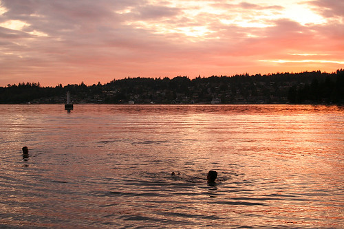
Belcarra Regional Park and Buntzen Lake Recreation Area are both located directly across Burrard Inlet from Barnet Marine Park. In hot months the beaches at Belcarra's Sasamat Lake and at nearby Buntzen Lake are so popular that park information signs will tell you if Belcarra and Buntzen are full. You can probably sense this on a hot day before you even leave the house. On weekends, unless you get an early start for their beaches, look elsewhere for a destination.
Once at Sasamat Lake, follow the signs to White Pine Beach. There's plenty of parking here on a benchland above the sandy beach. There's one critical difference between this beach and nearby Buntzen Lake: although the sun shines equally warm on both, the water in Buntzen is far colder than in Sasamat.
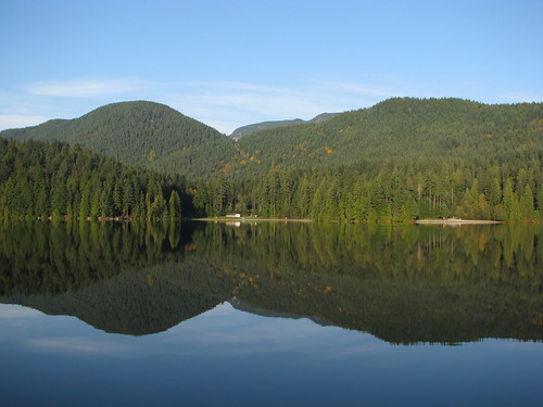
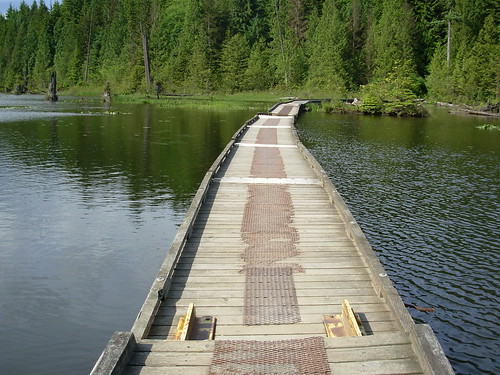
The Sasamat Lake Loop Trail (easy; 1.5 miles/2.5 km return) circles Belcarra's Sasamat Lake. Follow it around from White Pine Beach as it leads south to a floating boardwalk that crosses the lake. Two small docks for fishing and swimming are located along the walkway. The road that leads to the heart of Belcarra Park begins just before Sasamat Lake. Follow the signs to reach the main parking area. Detailed maps of Belcarra Regional Park are available year-round from the park's concession stand nearby.
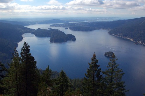
Belcarra has a tradition of being a summer picnic destination. Boats once brought day trippers from Vancouver's Coal Harbour to Belcarra for the day. Belcarra's picnic area has reservable picnic shelters and even a reservable wharf. Call (604) 432-6352 for more information. Admiralty Point Trail (easy; 3 miles/5 km return) begins from the main parking lot and heads south through second-growth forest and over a naturally cobblestoned trail to several good viewpoints. A 30-minute walk will have you at Admiralty Point and the Maple Beach picnic area. Even on cloudy days you'll find the open shoreline on Burrard Inlet is bright. Rocky outcroppings occur at points like Cod Rock, a perfect place to sit and watch the tide. Besides the view of Barnet and Mount Burnaby, you can also see Cates Park and Deep Cove to the west, and Mount Seymour rising above the entrance to Indian Arm, a fjord that stretches 11 miles (18 km) north.
Cod Rock Trail (moderate; 4 miles/7 km return) leads inland through tall second-growth forest from Cod Rock to Sasamat Lake and links with the Sasamat Lake Loop Trail. Yet another pathway, the Jug Island Trail (moderate; 3 miles/5 km return), begins beside the covered picnic shelter in the heart of the park. Much of the way along the trail is either up or downhill, with a series of wooden staircases for assistance in the steepest sections. Although there are few views along the way, there is a branch of the trail that leads out to an opening beside Bedwell Bay. From here you look east to the slopes of Eagle Ridge and the broad flank of Coquitlam Mountain. Depending on your pace it will take you between 30 and 45 minutes to reach pleasant cobble-and-sand Jug Island Beach from the Belcarra picnic grounds. (Jug Island actually lies offshore at the north end of a narrow peninsula.) For more information on Belcarra park's trail, phone (604) 432-6359.
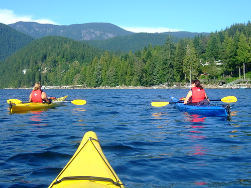
On a calm day, canoeists and paddlers can paddle over to explore the area around Belcarra's Admiralty Point. Just be mindful of the occasional large freighter that may be gliding slowly into one of the nearby oil terminals.
Belcarra is the place to head for underwater exploration in Indian Arm. As well as wading in from the beach beside Belcarra's pier, there's a small street-end park at Whiskey Cove on Coombe Road where divers also put in, located a 5-minute walk east of the picnic area. Other popular dive sites include nearby Indian Arm Provincial Marine Park's Racoon and Twin Islands. Farther up Indian Arm, Croker Island, a proposed regional park, is yet another.

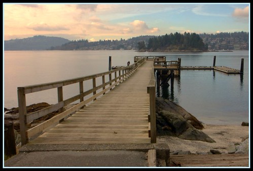
Anglers and crabbers use the dock at Belcarra as an excuse to spend some time in the outdoors. Water quality is often suspect, especially for its effect on bottom feeders, but this doesn't keep fishermen from enjoying their catch.
From Burnaby or Coquitlam it will take you 30 minutes to drive around the east end (Port Moody) of Burrard Inlet to reach Belcarra Regional Park and buntzen Lake Recreation Area. Follow Hastings Street east through Burnaby to its junction with the Barnet Highway, then east to Port Moody. As you enter Port Moody, turn left onto St. John's Street; six stoplights later, turn left again onto well-marked Ioco Road. Ioco Road soon turns left at an intersection marked by a green GVRD sign pointing the way to Belcarra. The route to Buntzen lies straight ahead at this well-marked intersection along Heritage Mountain Road. Note: There is no public parking in the village of Belcarra, so it is imperative to follow the road that leads to the park's main parking area.
No comments:
Post a Comment